
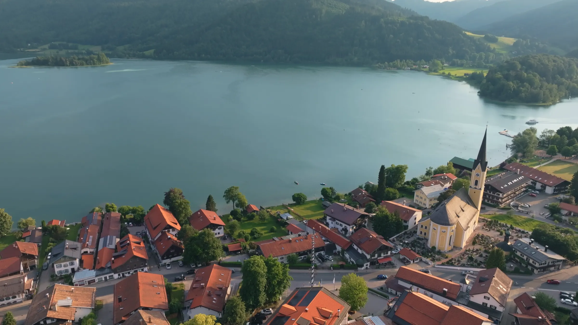
From lake
to lake
The Prinzenweg is a 14 km hike over the wooded ridge between Lake Schliersee and Lake Tegernsee, via the Gindelalm huts and the Neureuth mountain inn. It climbs about 570 metres, takes 3½ to 4½ hours of walking, needs no technical skill and ends at the Bräustüberl, Tegernsee’s monastery beer hall. You return by bus, train or taxi. If you want one day of hiking in the Bavarian Alps without a car, this is the one we recommend.
The hike in numbers
14.1km, official route
570metres of ascent
1,321metres, highest point on the path
3 to 4hours walking, in our experience
Why this is the hike to do in Bavaria
Lake to lake, no car, no scrambling, and a beer hall at the finish.
Most hiking in the Bavarian Alps starts and ends in the same car park. This one does not. You leave one lake in the morning, cross a ridge of 1,300 metres with views over both valleys, and walk down into a different town in the afternoon. In between are two alpine pastures with huts serving food, and a mountain inn that has been looking after walkers since 1895.
The route is called the Prinzenweg, the Princes’ Way. The official description from the regional tourist board is refreshingly honest about it: shortly before the Kreuzbergalm hut, today’s recommended route turns off towards the Gindelalm and leaves the original Prinzenweg, which forestry work has made less attractive over recent decades. The newer line has more footpath, better views and more places to eat. That is the route described here, and it is exactly the one we, the owners of the Terofal, send our guests on.
It suits people who walk regularly but are not mountaineers. There are no exposed sections, no rock and no via ferrata. What it asks of you is distance: about 14 kilometres and a long descent at the end.
Sources differ slightly. The tourist board gives 14.1 km and 570 m of ascent; the hiking portal Bergwelten measures 14.6 km and 620 m. Same hike, different GPS. The official walking time is 4½ hours; we tell our guests 3 to 4, which matches what fit walkers actually need. Plan a full day if you like long lunches.
A few words you will see on the signs
Alm, Hütte, Berggasthof, Bräustüberl: what they mean on the ground.
An Alm is a high summer pasture. Cattle are taken up in late spring and brought down in autumn, and many Almen have a hut that serves walkers simple food: bread, cheese, sausage, cake, beer and buttermilk. Most are open roughly May to October, and many take cash only.
A Hütte is a mountain hut in general; a Berggasthof is a proper mountain inn with a kitchen, often open all year. A Bräustüberl is the tavern of a brewery. The one in Tegernsee belongs to the brewery in the former Benedictine monastery, and for many walkers it is the point of the whole day.
The route, step by step
From Schliersee station to the beer hall in Tegernsee.
The official route starts at Schliersee railway station, at about 780 metres and seven minutes’ walk from our front door. It runs through the spa gardens to the lakeshore, south-west past the boat hire and the sailing club, across the little River Schlierach and through the edge of the village. Then the climb begins, through forest past the Gasthaus Hennerer, the first place to stop for coffee.
Higher up, the path heads towards the Kreuzbergalm at 1,223 metres. Just before it, the route turns west to the Gindelalm, at 1,242 metres in the saddle between the Auer Berg and the Gindelalmschneid. The Gindelalm is actually three huts side by side, all serving food in summer. This is the natural place for a long break: most of the climbing is done.
From the Gindelalm the path follows the ridge west. If you want a summit, climb the grassy slope behind the third hut to the cross on the Gindelalmschneid at 1,335 metres and rejoin the track on the other side. It adds very little time and gives one of the best views of the day.
Through forest and clearings you reach the Neureuth, a mountain inn at 1,264 metres with a terrace looking over the Tegernsee valley. From here it is all downhill: a broad meadow ridge, then forest, then the town of Tegernsee. Of the roughly 630 metres you descend over the whole hike, more than 500 come in this last section. Walking poles earn their keep here.
Stops along the way
- Schliersee station
- about 780 m, start
- Gasthaus Hennerer
- first café stop on the climb
- Kreuzbergalm
- 1,223 m, short detour
- Gindelalm
- 1,242 m, three huts, summer only
- Gindelalmschneid
- 1,335 m, summit cross, optional
- Neureuth
- 1,264 m, mountain inn, open all year
- Tegernsee
- about 730 m, finish at the Bräustüberl
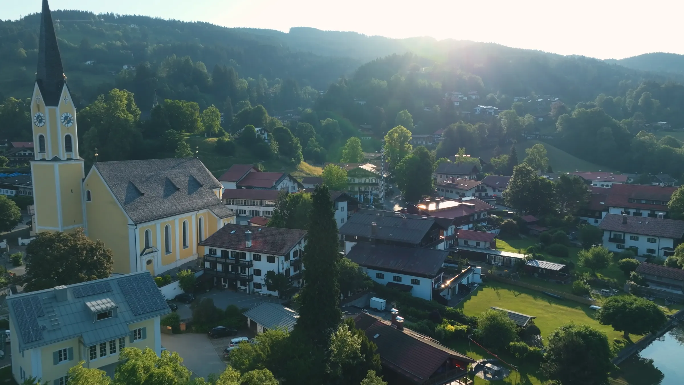
Huts and opening days: avoid Mondays
The one planning mistake people make on this hike.
Both the Gindelalm and the Neureuth usually close on Mondays. If a public holiday falls on a Monday, they close on the Tuesday instead. Walk this route on a Monday and you will find nowhere to eat between the Hennerer and Tegernsee.
The Gindelalm is a summer hut, usually open from May to October. It takes cash only, so bring euros. The Neureuth is open all year apart from Mondays and a winter break, which most recently fell in the weeks before Christmas. Hot food there is usually served only at lunchtime, from 11:30 to 14:30; after that it is cake and drinks. Check the huts’ websites, linked below, the evening before.
The finish: Tegernsee’s monastery beer hall
Brewing and serving rights since 1675.
The Herzogliches Bräustüberl sits in the former monastery on the Schlossplatz, in the middle of Tegernsee. A plaque by the bar carries the year 1675, when Abbot Bernhard Wenzl secured the right to brew and serve beer. Today it is a large vaulted hall where locals and hikers share long tables and nobody minds dusty boots.
According to its own website it is open daily from 10:00 to 22:00, with hot food until 21:30. You can book a table for four people or more; smaller groups simply find a seat.
Getting back: bus, train or taxi
And why a day trip from Munich works perfectly in this direction.
Back to Schliersee by bus: regional bus 355 (shown as 9555 on older timetables) runs from Tegernsee via Gmund to Schliersee and on to Bayrischzell. It runs only a few times a day and, on recent timetables, not late into the evening. Check the last departure in the MVV journey planner before you set off.
Back to Schliersee by train: trains on line RB 57 leave Tegernsee every half hour towards Munich. Change at Holzkirchen to the RB 55, which runs hourly to Schliersee. Slower than the bus, but it works in the evening.
By taxi: Tegernsee to Schliersee is about 11 km by road. Our reception will give you the number of a local firm and tell you whether to book ahead.
Coming from Munich for the day? Then this direction is ideal. The train from Munich Hauptbahnhof reaches Schliersee in about 50 minutes without changing. At the end of the hike you do not need to go back to Schliersee at all: the RB 57 runs from Tegernsee straight back to Munich every half hour.
Getting back at a glance
- Bus
- line 355, Tegernsee to Schliersee, a few times a day
- Train
- RB 57 to Holzkirchen, then RB 55 to Schliersee
- To Munich
- RB 57 direct from Tegernsee, every 30 minutes
- Taxi
- about 11 km, number at our reception
- Guest card
- free MVV travel in fare zones 6 to 9
If you stay overnight in Schliersee, you receive a Gästekarte, a guest card. It is included with your stay at the Terofal and lets you use all buses and trains in the Munich transport network (MVV) free of charge within fare zones 6 to 9, second class on regional trains. Schliersee, Tegernsee and Gmund all lie inside that area, so the bus back costs nothing. Carry photo ID: inspectors ask for it with the card. For the train via Holzkirchen, check the journey planner in case a supplementary ticket is needed.
How hard is it, and what to bring
Medium: long, not difficult.
The tourist board rates the route as medium and family-friendly. We agree, with one caveat: 14 km is a long day for children under about ten. The paths are forest tracks, meadow paths and short stretches of narrow trail. Nothing is exposed.
Wear proper hiking shoes with grip, because the descent to Tegernsee is slippery after rain. Take water for the climb, as there is nowhere to stop between the Hennerer and the Gindelalm, and cash for the huts. In winter people walk the Prinzenweg too, and the Neureuth stays open, but the Almen are closed, the ridge is often snowy and everything takes longer. Check the mountain forecast and ask us in the morning how things look up top.
For a slightly shorter version, start up through Breitenbach to the Almbad Huberspitz inn at 1,051 m, then follow the ridge over the Auer Berg to the Gindelalm and on as above. The mountain portal hoehenrausch.de gives 12.2 km, about 580 m of ascent and 4 hours for it.
A day plan that works
Breakfast, start, lunch on the mountain, dinner in Tegernsee.
Breakfast at the Terofal starts at 7:30. Leave around 8:30 and you reach the Gindelalm around midday and the Neureuth in the early afternoon. That is tight for hot food at the Neureuth but perfect for a snack on the Alm and cake on the terrace. You should be in Tegernsee by 15:00 or 16:00, with time for a beer, a walk along the shore and the afternoon bus.
Back at the hotel, six of our rooms have their own private sauna. After 14 km and 600 metres down, that stops being a luxury.

Addresses and sources
Every link goes to the operators themselves. Times and prices change, so please check them there.
Alpenregion Tegernsee Schliersee
The regional tourist board for both valleys, with the official route description and GPX track.
Gindelalm
One of the three huts on the Gindelalm pasture, 1,242 m. Season, rest day and current notices (German).
Berggasthof Neureuth
Opening hours, rest day and winter closure of the mountain inn above Tegernsee (German).
Bräustüberl Tegernsee
The brewery tavern in the former monastery: opening hours and table bookings for four or more.
MVV journey planner and guest card
Buses and trains between Tegernsee, Schliersee and Munich, plus where the guest card is valid.
German Weather Service (DWD)
Mountain weather and warnings for the Miesbach district.
Bayerische Regiobahn
Timetables and tickets for the line from München Hauptbahnhof to Schliersee.
Common questions.
How long is the hike from Schliersee to Tegernsee?
About 14 km. The official route measures 14.1 km with 570 m of ascent and 633 m of descent; Bergwelten gives 14.6 km. Expect 3½ to 4½ hours of walking, plus breaks.
Is the Prinzenweg a good hike in the Bavarian Alps for beginners?
Yes, for anyone who walks regularly. There are no exposed sections or rock, and the tourist board rates it medium and family-friendly. The challenge is the distance and the 500-metre descent at the end, not the terrain.
Can I do this hike as a day trip from Munich?
Yes. Take the train from Munich Hauptbahnhof to Schliersee, about 50 minutes without changing, walk to Tegernsee, then take the RB 57 from Tegernsee straight back to Munich. It runs every half hour.
How do I get back from Tegernsee to Schliersee?
By regional bus 355 via Gmund, which runs only a few times a day; by train via Holzkirchen (RB 57, then RB 55); or by taxi, about 11 km by road. With the Schliersee guest card the bus is free.
Are the huts open on Mondays?
Usually not. The Gindelalm and the Neureuth both have Monday as their rest day, moving to Tuesday when Monday is a public holiday. Pick another day if you want lunch on the mountain.
When is the Gindelalm open?
Usually from May to October. It takes cash only. The Neureuth, further along, is open all year except Mondays and a break before Christmas.
Can you hike from Schliersee to Tegernsee in winter?
Yes, in suitable conditions. The Neureuth stays open, but the Gindelalm and Kreuzbergalm are closed, the ridge is often snowy and the walk takes longer. Check the mountain forecast before you go.
What is the Bräustüberl in Tegernsee?
The tavern of the Tegernsee brewery, in the former monastery on the Schlossplatz. Its brewing and serving rights date from 1675. It opens daily from 10:00 to 22:00 and is the traditional finish of this hike.
Read on
Start from here
Our house stands in the middle of the village, seven minutes on foot from the station and four from the water. Reception is happy to help with questions about the region, daily from 7:30 am to 8 pm on +49 8026 92921-0.