
Hiking
at Schliersee
Schliersee is one of the few places in the Bavarian Alps where serious hiking starts at a railway station: the direct train from Munich takes 50 minutes, and the trails begin in the village at 777 metres. Within a day you can walk an easy loop to a medieval castle ruin, cross the hills to Lake Tegernsee, or climb summits between 1,668 and 1,884 metres. Below are the four hikes the owners of the Terofal recommend most, with what they demand.
From the shore upwards
777metres, the lake shore
1684metres, Brecherspitz
1759metres, Aiplspitz
1884metres, Rotwand
Why Schliersee for hiking near Munich
The village sits at 777 metres. Everything around it is higher, and almost all of it starts on foot.
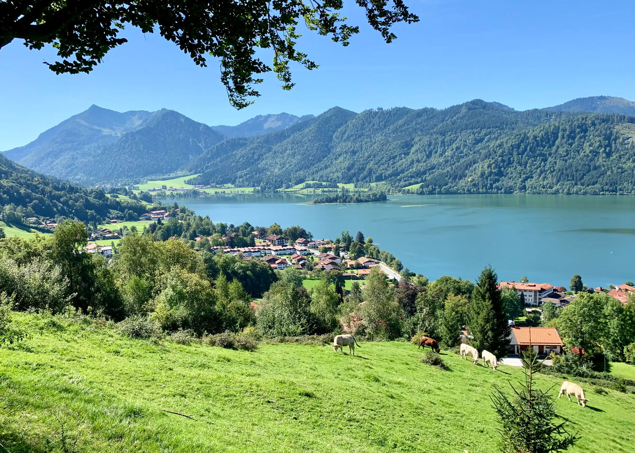
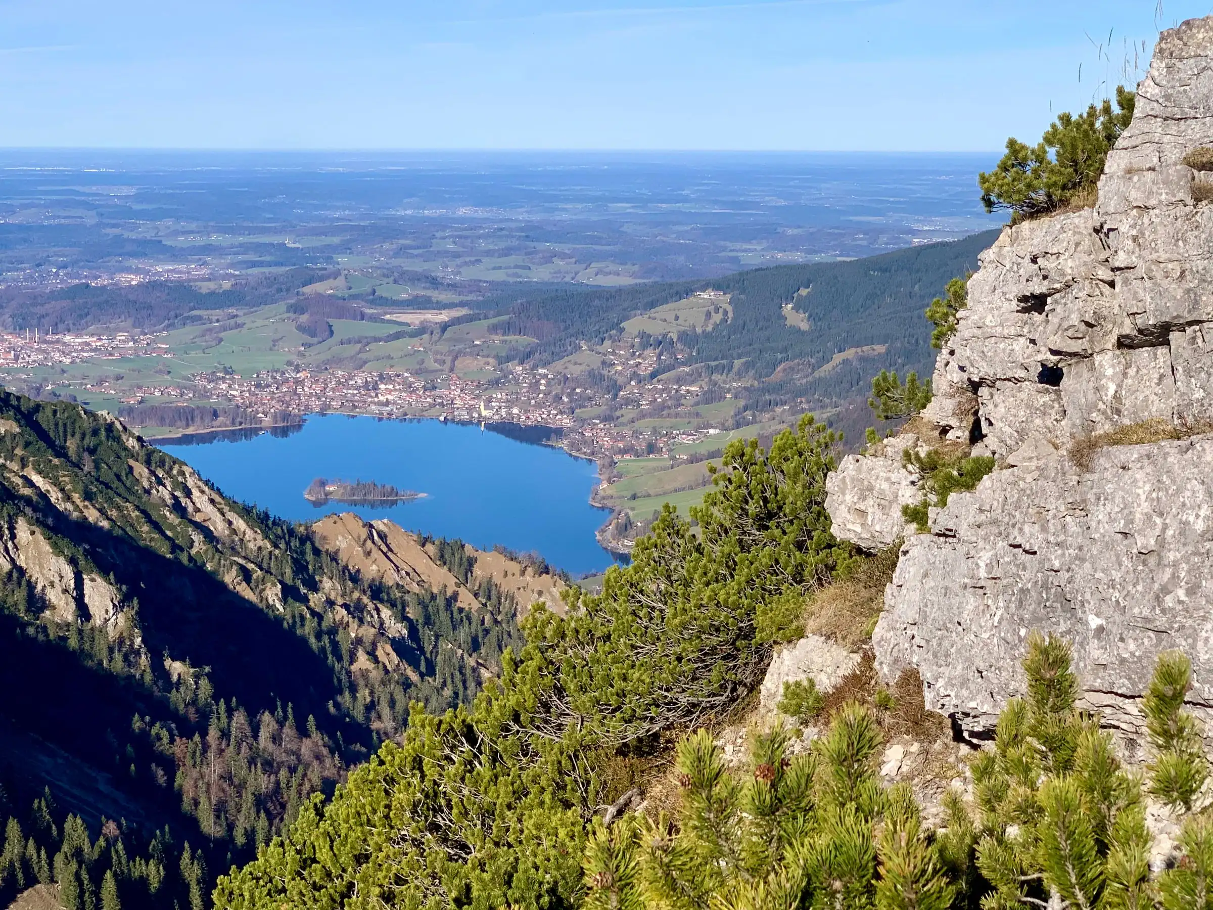
Most hiking in the Bavarian Alps begins with a drive to a car park. At Schliersee it begins at the station. The lake lies at 777 metres in a valley that rises on every side, and the mountains around it, the Schliersee group of the Mangfall Mountains, are what people in Munich call their Hausberge, their home mountains. From the shore you can see four summits: Aiplspitz, Jägerkamp, Brecherspitz and Bodenschneid.
The ground changes character halfway down the lake, and you notice it under your boots. North of the middle lies the Flysch zone: rounded, forested hills such as the Huberspitz, Aschberg and Gindelalmschneid, with paths through woodland and views from the clearings. South of it the Northern Limestone Alps begin. There the summits rise above the tree line, rock comes through, and a walk becomes a mountain hike.
For visitors this means a practical choice every morning. When cloud sits on the limestone peaks or snow lingers on their north faces in spring, the Flysch hills to the north are usually still good. When the weather is clear, the summits are a bus ride away.
How trails are graded in Germany, and what an Alm is
Blue, red, black: the colours on the yellow signposts mean the same as on a ski slope.
Mountain paths in Bavaria are signed with yellow signposts that give destinations and walking times in hours. A coloured dot on the sign tells you the grade, and the system follows the ski pistes. Blue means an easy mountain path: often narrow, can be steep, but without sections where a fall would be dangerous. Red means intermediate: narrow, often steep, with short exposed sections. Black means difficult: exposed, with cable-secured passages or easy scrambling where you need your hands, and you must be sure-footed and have a head for heights. That is the German Alpine Club’s definition, and it is applied consistently.
The times on the signposts assume a steady pace without breaks. Most visitors are slower on their first day, and that is fine.
Two words you will meet everywhere. An Alm (or Alpe) is a summer mountain pasture, usually with a hut where cattle are kept from late spring to autumn. Many Almen serve food and drink in season; they are then called bewirtschaftet. A Brotzeit is the cold Bavarian snack you eat there: bread, cheese, sausage, perhaps a radish. A Hütte in the Alpine Club sense is a mountain hut with beds and a kitchen, open to everyone, often for much of the year. Opening times of Almen depend on the season and the weather; check before you rely on one for lunch.
Our four favourite hikes from the front door
Ute and Markus Leitner’s own recommendations, from easy to serious.
Ute and Markus Leitner run the Terofal and have lived with these mountains for years. When guests ask at reception which walk they should do, these are the four answers they give most often. The times are theirs, for walking without long stops.
1. Easy: along the lake to the Hohenwaldeck castle ruin (2 to 3 hours)
Walk south along the shore to Fischhausen at the end of the lake, climb to the ruin of Hohenwaldeck castle and come back over the Oberleiten, the high meadows on the east side. The ruin stands at 986 metres, 209 metres above the lake, and dates from the late 13th century. It was closed in 2020 because parts were at risk of collapse; the Bavarian state forestry restored it, with materials flown in by helicopter, and it has been open again since 2024. From the viewpoint you look down the full length of the lake. This is the walk we suggest for an arrival afternoon or a day with grey skies.
2. Medium: over the Gindelalm and Neureuth to Lake Tegernsee (3 to 4 hours)
A classic crossing from one lake to the next, largely on the route known as the Prinzenweg. You climb north-west out of Schliersee to the Gindelalm (about 1,240 metres), pass the Gindelalmschneid (1,335 metres) and continue to the Neureuth (1,264 metres), where a mountain inn has stood since 1895. From there a path leads down to Tegernsee, and our suggestion is to finish at the Herzogliches Bräustüberl, the brewery tavern in the old monastery. Tour sources give 12 to 15 kilometres and roughly 570 to 620 metres of ascent. Paths are mostly wide; the slope below the Gindelalmschneid is steep and slippery when wet. You come back by bus or taxi; ask us for the current bus connection before you set off.
3. Difficult: Brecherspitz from the Spitzingsattel (4 to 5 hours)
The Brecherspitz (1,684 metres) is the pyramid you see from the lake, Schliersee’s own mountain. Start at the Spitzingsattel pass (1,129 metres), reached by bus 362, and take the normal route past the Obere Firstalm and the Freudenreich chapel on the west ridge to the summit: about 560 metres of ascent, around two hours up. Coming back, descend the same way to the Obere Firstalm for a break. Ute and Markus put the whole round at 4 to 5 hours and are clear that it is for experienced hikers only: there are cable-secured, exposed sections on the ridge, and you must be sure-footed and free from vertigo. There have been fatal falls.
One warning that matters. Directly from the Spitzingsattel an unmarked path climbs the east ridge. It is steep, exposed, has short climbing passages and is dangerous when wet. A sign at the top warns not to descend that way. Unless you are an experienced scrambler, stay on the marked normal route via the Firstalm.
4. Difficult: Rotwand from Spitzingsee via the Rotwandhaus (4 to 5 hours)
The Rotwand (1,884 metres) is the highest summit of the area and one of the best-known of Munich’s home mountains. From Spitzingsee (1,084 metres), take the bus up from Schliersee, then follow the broad forest track to the Rotwandhaus at 1,737 metres, an Alpine Club hut that is open for most of the year and serves hot food. The last hundred or so metres to the summit run up a well-made path across the grassy top slope. In total it is about 800 to 850 metres of ascent. Ute and Markus walk it in 4 to 5 hours there and back; tour guides give up to 6. Technically it is easier than the Brecherspitz, but it is long, and the weather on top can be very different from the lake.
The four hikes in brief
- 1. Hohenwaldeck ruin
- easy, 2 to 3 h, ruin at 986 m
- 2. Gindelalm, Neureuth, Tegernsee
- medium, 3 to 4 h, about 600 m up
- 3. Brecherspitz
- difficult, 4 to 5 h, 560 m up from the saddle
- 4. Rotwand via Rotwandhaus
- difficult, 4 to 5 h, about 800 m up
- Start for 1 and 2
- the Terofal’s front door
- Start for 3 and 4
- bus 362, free with guest card
- Best months for the summits
- May to October
Easy walks: the lake path and the Alm level
A few hundred metres of climbing, woodland, meadows and a view without suffering.
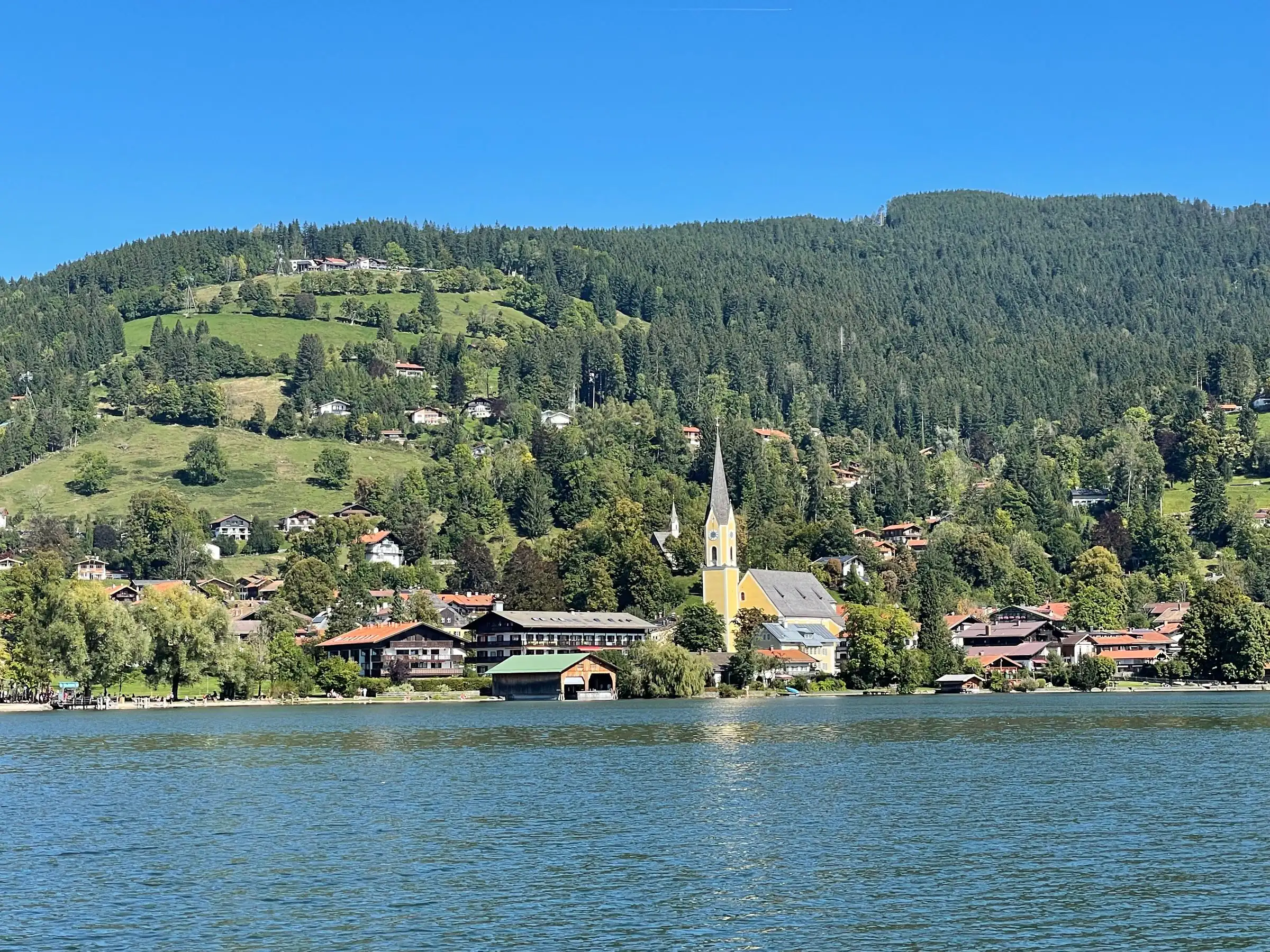
The path around the lake is 7.4 kilometres long, practically flat and almost always by the water. The lake is small enough, about 2.5 by 1.25 kilometres, that you can always see the other shore. It is the best first orientation: after two hours you know where the village is, where Fischhausen starts, where the island sits and in which direction the mountains rise.
Directly above the village is the Schliersbergalm, reached by a cable car. From the top you see the whole lake with the island in the middle. Walking up and riding down, or the other way round, is the gentlest way to a big view here, and it suits families and tired knees.
For a meal on an Alm, Ute and Markus name the Freudenreichalm as their favourite, followed by the Gindelalm, the Kreuzbergalm, the Ankelalm and the Obere Firstalm, all reachable on foot or by e-bike. On the west side, about 300 metres below the summit of the Bodenschneid, the Bodenschneidhaus is an Alpine Club hut that is normally open all year.
The summits you see from the lake
Brecherspitz, Jägerkamp, Aiplspitz and Bodenschneid. All above the tree line, all reachable without a car.
The Brecherspitz (1,684 metres) was first recorded between 1078 and 1080, in a boundary description of the Prince-Bishopric of Freising, as mons Spizzinch. It is considered one of the rock summits reached most quickly from Munich, and in winter a popular ski tour.
The Jägerkamp (1,746 metres) lies east of the Spitzingsattel. A ridge runs east from it over the Benzingspitz (1,735 metres) to the Aiplspitz, which makes a longer ridge walk possible.
The Aiplspitz (1,759 metres) is the highest of the four visible from the village. It is made of platy limestone, and the Bavarian Environment Agency lists it as a geotope because of the cirques on its east and north sides.
The Bodenschneid (1,668 metres) stands between Tegernsee, Schliersee and Spitzingsee, exactly on the municipal boundary. It is a long ridge, open on top, and its summit cross is one of the largest in Bavaria.
From the breakfast table at 777 metres to the tree line is closer than most guests expect.
Getting here from Munich and the airport
One direct train from the city. Local buses free with the guest card.
From Munich Hauptbahnhof the Bayerische Regiobahn (BRB) runs directly to Schliersee in about 50 minutes, hourly to half-hourly from about 6 am to midnight. The Deutschlandticket is valid. From Munich Airport take the S-Bahn (S1 or S8) to the Hauptbahnhof and change; allow about an hour and three quarters. The Terofal is a seven-minute walk from Schliersee station.
Up in the valley you do not need a car. Bus 362 runs from Schliersee to the Spitzingsattel and Spitzingsee, usually hourly. The same BRB line continues south through Fischhausen-Neuhaus to Bayrischzell, with trailheads near several stations.
The guest card, or Gästekarte, is what makes this cheap. Every overnight guest receives one from their host; at the Terofal you get it at check-in. With photo ID it is a free ticket on buses and trains in MVV zones 6 to 9, which covers the buses around Schliersee and Spitzingsee and the trains from Miesbach southwards. It also includes the tourist office’s programme of guided walks. In spring and autumn the village of Schliersee also runs hiking weeks, and the guided hikes are free for Terofal guests; ask at reception for the dates. If you arrive by car, parking at the hotel is free, and you can leave the car there all week.
When to go and how to prepare
May to October for the summits. Check three things the evening before.
The summits are best from May to October. In April and early May snow often lies longer on the northern slopes of the limestone peaks than it looks from below; then walk the Flysch hills north of the lake instead. Autumn is the clearest and quietest season.
Before any route above the Alm level, check three things: the German Alpine Club for path conditions and hut opening, the Deutscher Wetterdienst for mountain weather, and in winter the avalanche bulletin. All are linked below. This is not a formality. It is the difference between a good day and one nobody wants to talk about.
And ask us. We live here, we see every morning where the cloud sits, and we have a fairly good idea of which hike suits which guest.
Addresses and sources
Every link goes to the operators themselves. Times and prices change, so please check them there.
German Alpine Club (DAV)
Trail conditions, hut opening and the official definition of trail grades.
Deutscher Wetterdienst
Mountain weather and warnings for the Miesbach district.
Rotwandhaus
The Alpine Club hut below the Rotwand at 1,737 metres: opening, food and beds.
Bodenschneidhaus
Alpine Club hut below the Bodenschneid, with current opening hours.
Schliersbergalm
The mountain above the village, with a cable car and a view down the whole lake.
Alpenbahnen Spitzingsee
Summer lifts at Spitzingsee, including the Taubenstein gondola, with operating days.
Guest card (Gästekarte)
What the guest card covers: buses and trains in MVV zones 6 to 9, guided walks, discounts.
Bayerische Regiobahn (BRB)
Timetables for the direct line from Munich Hauptbahnhof to Schliersee.
Common questions.
Where is the best hiking near Munich without a car?
Schliersee is one of the easiest choices: the direct BRB train from Munich Hauptbahnhof takes about 50 minutes, trails start in the village, and bus 362 takes you on to Spitzingsee for the higher summits such as the Rotwand and Brecherspitz.
What are easy hikes at Schliersee?
The 7.4-kilometre lake path is practically flat. The walk to the Hohenwaldeck castle ruin above Fischhausen takes 2 to 3 hours with a little over 200 metres of climbing. The Schliersbergalm above the village has a cable car, so you can walk one way and ride the other.
Can you hike from Schliersee to Tegernsee?
Yes. The route over the Gindelalm and the Neureuth to Tegernsee is 12 to 15 kilometres with roughly 600 metres of ascent, about 3 to 4 hours of walking. You return by bus or taxi.
How difficult is the Brecherspitz?
Difficult. The normal route from the Spitzingsattel via the Obere Firstalm has about 560 metres of ascent and cable-secured, exposed sections on the ridge. It needs sure-footedness and a head for heights; allow 4 to 5 hours. Avoid the unmarked east ridge directly from the saddle.
How long does it take to hike the Rotwand?
From Spitzingsee via the Rotwandhaus, about 4 to 6 hours there and back, with 800 to 850 metres of ascent. The Rotwand is 1,884 metres high; the Rotwandhaus hut at 1,737 metres serves food for most of the year.
What do the colours on German hiking signs mean?
Blue is an easy mountain path, red is intermediate with short exposed sections, black is difficult with exposed, cable-secured or scrambling passages. The grades are set by the German Alpine Club and shown as a dot on the yellow signposts.
When is the best time for hiking in the Bavarian Alps around Schliersee?
May to October for the summits. In April and early May snow can linger on north-facing limestone slopes, so the wooded Flysch hills north of the lake are the better choice. Autumn tends to be the clearest and quietest time.
Are buses to the trailheads free?
For overnight guests, yes. The Schliersee guest card, which you receive from your host, is a free ticket on buses and trains in MVV zones 6 to 9 when shown with photo ID, including bus 362 to the Spitzingsattel and Spitzingsee.
Are there guided hikes at Schliersee?
Yes. In spring and autumn the village of Schliersee runs hiking weeks with guided hikes. For guests of the Terofal they are free.
Read on
Start from here
Our house stands in the middle of the village, seven minutes on foot from the station and four from the water. Reception is happy to help with questions about the region, daily from 7:30 am to 8 pm on +49 8026 92921-0.