
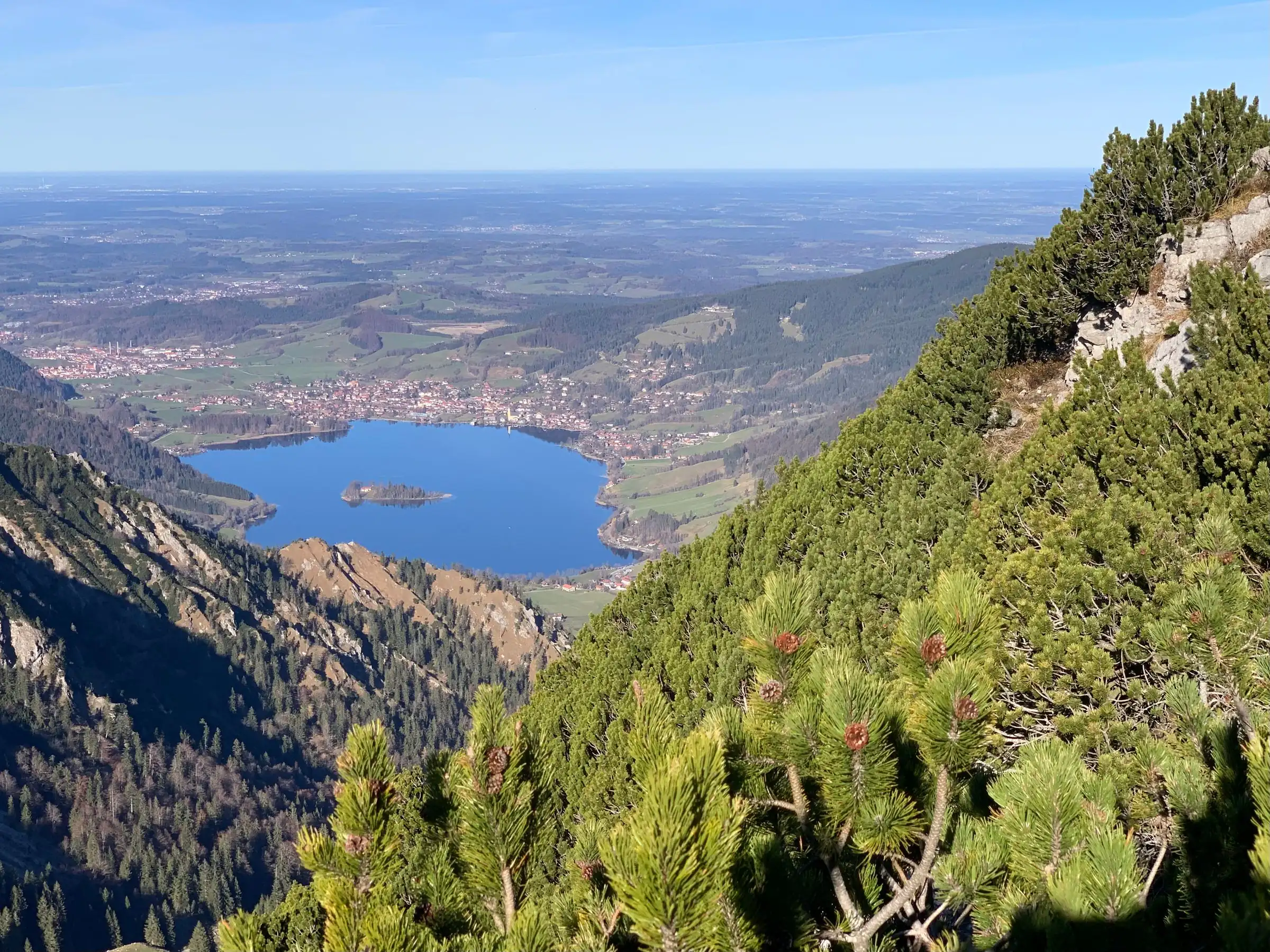
Which mountain
is that?
From the shore of the Schliersee you look at four mountains: the Aiplspitz (1,759 m), the Jägerkamp (1,746 m), the Brecherspitz (1,684 m) and the Bodenschneid (1,668 m). This page names every peak around the Schliersee and the Spitzingsee, with height and position, and explains why some are round and wooded while others are bare rock.
The four from the shore
1,759metres, Aiplspitz
1,746metres, Jägerkamp
1,684metres, Brecherspitz
1,668metres, Bodenschneid
Four mountains in plain view
Aiplspitz, Jägerkamp, Brecherspitz and Bodenschneid. You do not have to go anywhere to see them.
From the village of Schliersee four mountains stand in plain view: the Aiplspitz, the Jägerkamp, the Brecherspitz and the Bodenschneid. All four belong to the Mangfall mountains in the Bavarian Prealps. To see them you only need to stand on the shore and turn round once.
The group most of them belong to is simply called the Schlierseer Berge, the Schliersee mountains, and forms the middle part of the Mangfall range. The whole range counts among Munich’s Hausberge, its “house mountains”, and that is not a marketing phrase but a matter of driving time: the Brecherspitz is said to be one of the rocky summits you can reach fastest from Munich.
The most striking is the Brecherspitz at 1,684 metres. Its pyramid shape is impossible to miss from the water. It stands a good three kilometres south-south-west of Neuhaus, and its east ridge runs down to the Spitzingsattel pass. It was first mentioned between 1078 and 1080, in a boundary description of the Prince-Bishopric of Freising, as “mons Spizzinch”, the Spitzing mountain. The name is almost a thousand years old.
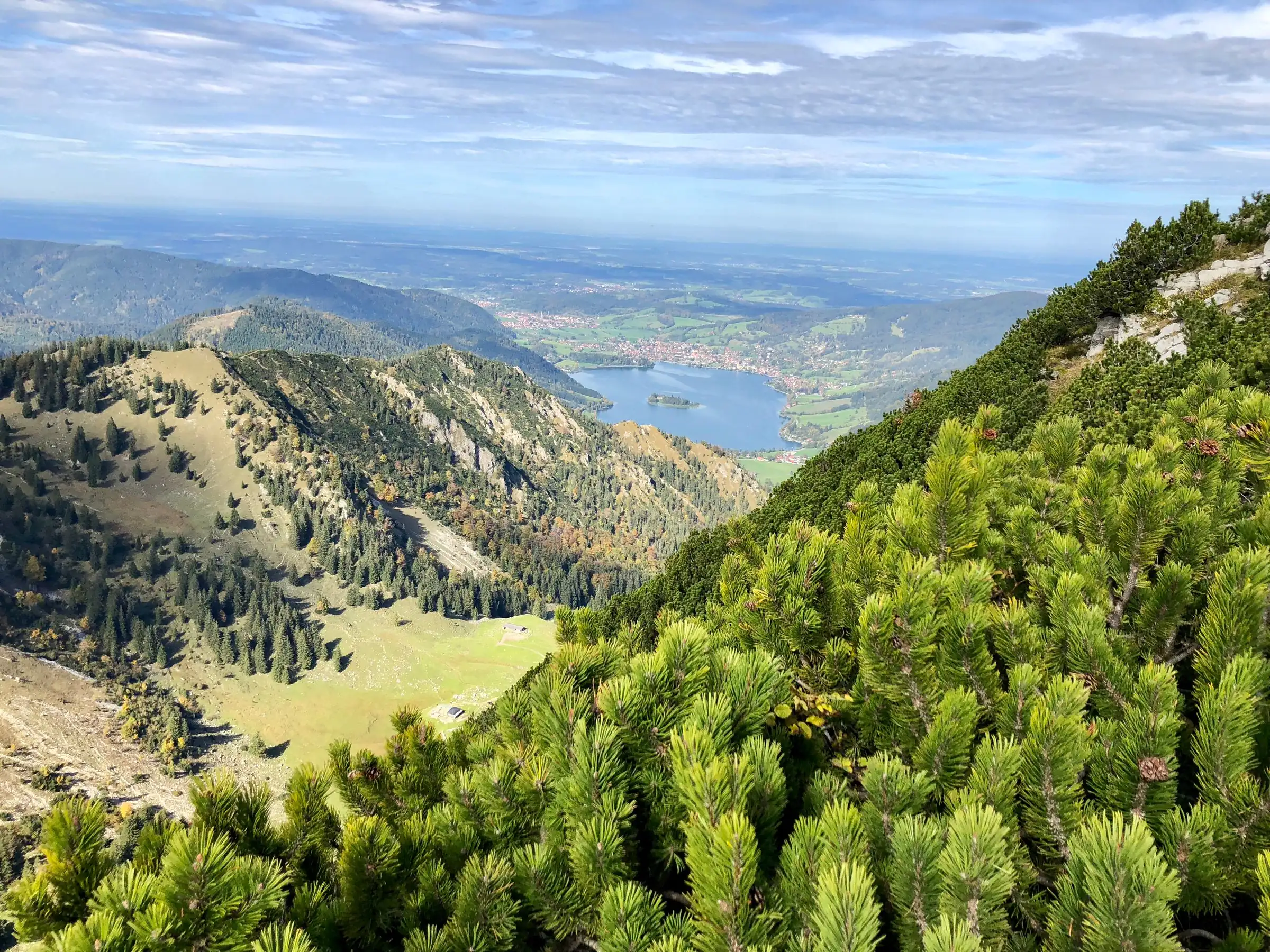
Why some are rounded and others rugged
A geological boundary runs through the middle of the lake. You can see it in the mountains.
The northern part of the lake lies in the Flysch zone, a belt of soft sandstone and marl; the southern part already lies in the northern range of the Limestone Alps. The boundary runs straight across the water, and it explains why the landscape looks so different to the north and to the south.
The Flysch hills around the northern half of the lake are mostly wooded, rounded tops, more like low hill country: the Huberspitz, Rainer Berg, Auer Berg, Gindelalmschneid, Aschberg, Krainsbergkogel, Schliersberg and Breitenberg. The underwater ridge with the island of Wörth is made of the same material, the Kalkgraben Formation, named after a former quarry in Kalkgraben, a part of Schliersee.
South of it the Schliersee mountains begin, a section of the Mangfall range in the Northern Limestone Alps. In many respects they already count as high mountains, because their summits rise above the tree line. That is exactly what you see from the shore: green ridges in front, bare rock behind.
The whole basin was scoured out by a glacier during the last (Würm) ice age, a tongue basin running north to south. Moraines and glacial gravels lie on top of the older rock.
Green ridges in front, bare rock behind. Between them runs a boundary that crosses the lake.
The peaks around the Spitzingsee
Five kilometres further south and three hundred metres higher, the list gets longer.
Five kilometres south of the Schliersee, the Spitzingsee lies at 1,084 metres. Drive up there and you stand among the best-known summits of the Mangfall range: the Jägerkamp, Aiplspitz, Rauhkopf, Taubenstein, the Rotwand at 1,884 metres, the Ruchenköpfe, Stolzenberg, Rotkopf, Roßkopf, Stümpfling, Bodenschneid and Brecherspitz.
The Jägerkamp is 1,746 metres high and lies east of the Spitzingsee, south of Neuhaus. To the east a ridge runs over the Benzingspitz (1,735 m) to the Aiplspitz; to the west the Spitzingsattel separates it from the Brecherspitz. To the south lie the Rauhkopf and the former ski area on the Taubenstein.
At 1,759 metres the Aiplspitz is the highest of the summits visible from the village and belongs to the Rotwand group. It is made of platy limestone, and its east and north faces show clear cirques, the bowl-shaped hollows left by glaciers, for which the Bavarian Environment Agency has listed it as a valuable geotope. Its name comes from the Geitauer Alpl, a pasture called Aibl in dialect. Old maps also give it as Eibelspitz or Alplspitz.
The Bodenschneid, at 1,668 metres, sits exactly on the boundary between the municipalities of Rottach-Egern and Schliersee, between three lakes. It is a long ridge, open at the top, with steep drops to the north-east. Its summit cross is among the largest in Bavaria, and the slightly lower south-east spur at 1,653 metres carries a cross too. About three hundred metres below the top is the Rettenbäckalm with the Bodenschneidhaus, a German Alpine Club hut open all year.
Every peak at a glance
- Rotwand
- 1,884 m, Rotwand group
- Aiplspitz
- 1,759 m, geotope, platy limestone
- Jägerkamp
- 1,746 m, east of the Spitzingsee
- Benzingspitz
- 1,735 m, on the ridge to the Aiplspitz
- Brecherspitz
- 1,684 m, the local mountain
- Bodenschneid
- 1,668 m, very large summit cross
- Bodenschneid south-east spur
- 1,653 m, with a second cross
- Hirschgröhrkopf
- 1,260 m, east of Fischhausen
- Brunstkogel
- 1,251 m, west of Fischhausen
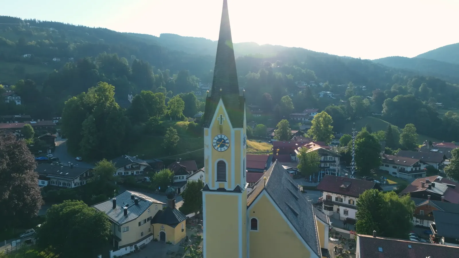
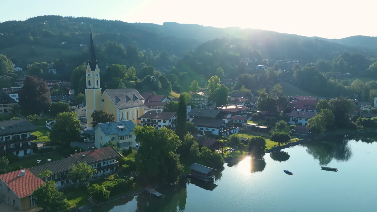
The view you do not have to hike for
The Schliersbergalm above the village can be reached by cable car.
Directly above the village is the Schliersbergalm, an Alm (a mountain pasture with an inn), and a cable car goes up to it. From the top you see the whole length of the lake, with the island of Wörth in the middle and the mountain chain behind. It is the view from the postcards, and the only one at that height you do not need to hike for.
If you want to learn to name the peaks, start up there. From below their outlines overlap; from above they stand one behind the other and are easy to tell apart.
After that the view from the shore works differently. You no longer see mountains, you see the Brecherspitz, the Jägerkamp and the Bodenschneid. It is a small difference, but it changes a week’s holiday more than you would think.
Addresses and sources
Every link goes to the operators themselves. Times and prices change, so please check them there.
German Alpine Club (DAV)
Trail conditions, hut opening and safety advice for the mountains around the lake.
Schliersbergalm
The mountain above the village, with a cable car, a summer toboggan run and a view over the lake.
Alpenbahnen Spitzingsee
Lifts and cable cars at the Spitzingsee, in winter and in summer.
Bavarian Environment Agency (LfU)
The official register of geotopes, including the Aiplspitz, plus bathing water data.
Deutscher Wetterdienst
Mountain weather and warnings for the Miesbach district.
Schliersee tourist office
The municipality’s official site, with events, the guest card and current notices.
Bavarian Avalanche Warning Service
The current avalanche bulletin. Essential reading before any winter tour in the Mangfall mountains.
Common questions.
Which mountains can you see from the Schliersee?
Four summits are in plain view from the village: the Aiplspitz at 1,759 metres, the Jägerkamp at 1,746, the Brecherspitz at 1,684 and the Bodenschneid at 1,668 metres. All four belong to the Mangfall mountains in the Bavarian Prealps.
What is the local mountain of Schliersee called?
The Brecherspitz, 1,684 metres. It has a distinctive pyramid shape, stands a good three kilometres south-south-west of Neuhaus and was first mentioned between 1078 and 1080 as “mons Spizzinch”.
What is the highest mountain at the Schliersee?
Of the summits visible from the village, the Aiplspitz at 1,759 metres. A little further south, around the Spitzingsee, the Rotwand at 1,884 metres is the highest of the well-known peaks of the Mangfall range.
Why do the mountains north and south of the lake look so different?
Because a geological boundary runs through the middle of the lake. The northern part lies in the Flysch zone, with wooded, rounded hills; the southern part already lies in the Limestone Alps, where the summits rise above the tree line.
Is there a viewpoint you can reach without hiking?
Yes, the Schliersbergalm directly above the village, reached by cable car. From the top you see the whole length of the lake with the island in the middle and the mountain chain behind.
Which peaks surround the Spitzingsee?
The Jägerkamp, Aiplspitz, Rauhkopf, Taubenstein, the Rotwand at 1,884 metres, the Ruchenköpfe, Stolzenberg, Rotkopf, Roßkopf, Stümpfling, Bodenschneid and Brecherspitz. The Spitzingsee itself lies at 1,084 metres.
Read on
- Hiking from Schliersee
How to get up these mountains: our hosts’ hikes from the front door, with honest times.
- Walking around the Spitzingsee
A flat loop at 1,084 metres, right among the peaks of the Mangfall range.
- Rooms at the Terofal
Six room types in the centre of Schliersee, four minutes’ walk from the lake.
Start from here
Our house stands in the middle of the village, seven minutes on foot from the station and four from the water. Reception is happy to help with questions about the region, daily from 7:30 am to 8 pm on +49 8026 92921-0.